Raetic Culture: Scientific Regional Studies using State-of-the-Art Technologies
During the pre-Roman Iron Age from about 500 BC to the birth of Christ, the Central Alpine Region between East Tyrol and Lower Engadine as well as between the foothills of the South German Alps and the Trentino was inhabited by a people ancient sources called Raeti. For the first time, at the end of the sixth century BC, the Raeti on both sides of the Alpine Ridge developed a common culture with defined characteristics: richly decorated pottery, house constructions, often with two storeys, built right into the hillside, burnt-offering areas with votive figurines representing gods or heroes and inscriptions featuring their own Etruscan-related alphabet.
Since the Roman invasion into Northern Italy during the first century BC and especially after the conquest of the Alpine Region, Mediterranean influences increase. Excavations and finds mark the onset of the Roman Imperial Period as a distinctive break: Local settlements end abruptly, and within a very short timeframe, archaeological evidence of the Raeti’s material culture is no longer evident.
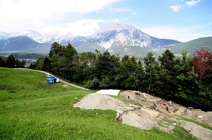
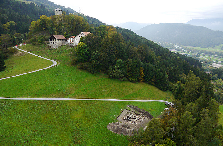
The largest Iron Age settlement of North Tyrol is located in Pfaffenhofen-Hörtenberg and represents the focus area for the research of pre-Roman Iron Age in the Alpine Region. Located in the Telfs Basin in Tyrol’s upper Inn Valley, west of Innsbruck. Here research concentrates on consistency, change and breach of cultural phenomena during the decades surrounding the birth of Christ.
Raetic Culture: Excellent Research Conditions in Pfaffenhofen-Hörtenberg
Since the Roman invasion into Northern Italy during the first century BC and especially after the conquest of the Alpine Region, Mediterranean influences increase until the Raetic culture eventually merges into the Roman culture. Questioning whether this alleged breach in the archaeological findings does reflect historic reality, and if there actually was a profound change of population, represents one of the crucial issues with the pre-Roman Iron Age research – and a matter of debate in the archaeology of South Germany and the Alpine countries.
Pfaffenhofen-Hörtenberg provides the opportunity to test this in an ideally suited location. The finds from early Academy excavations cover a time period of about 500 years, from Late Hallstatt to the latest Raetic phase. Also known was the settlement’s burnt-offering area at the neighbouring Trappeleacker, where Austrian excavations already had taken place. The initial situation therefore was perfect for the focus on early Roman Period research and the venture from 2012 until 2025.
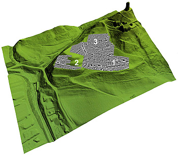
Magnetometer Prospection: Looking for Suitable Areas with Geophysical Methods
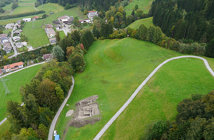
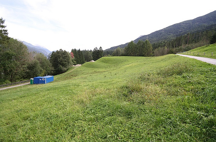
Complex and partially very deep-reaching layer sequences are typical for the settlement’s archaeology, their research requires a great amount of time. The settlement’s terrace structure in North Tyrolean Pfaffenhofen covers nearly two hectares (20.000 squ. m. or 215278 squ. ft). From the very beginning it was obvious that this area was too large to be exposed completely: therefore the most promising areas had to be detected, defined and decided on by using geophysical methods.
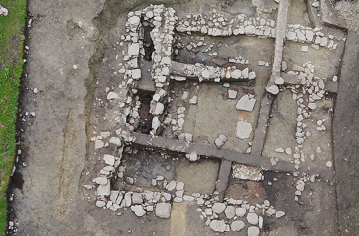
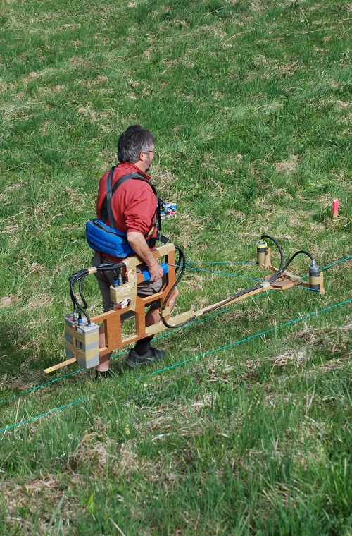
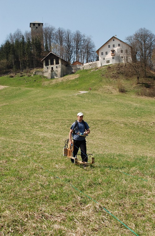
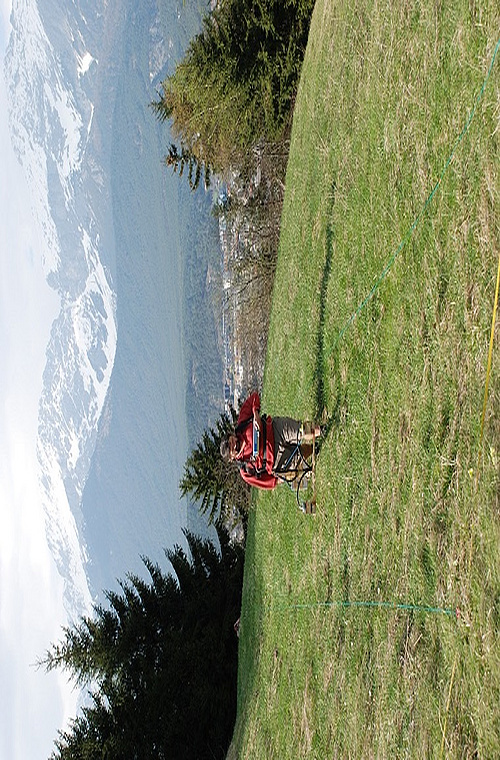
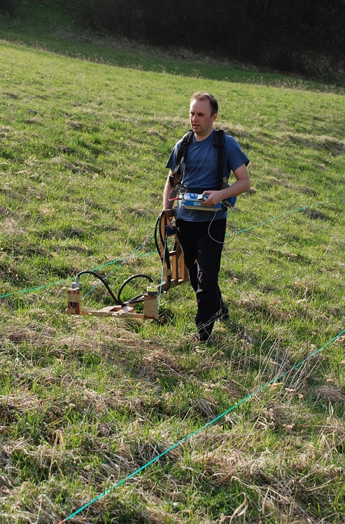
Specific devices enable measurement of physical differences between soil and archaeological remains like pits and walls. These devices record magnetism or reactions to electric impulses. Data recovered can be adapted to plans and thereby render sub-terranean finds visible. A magnetometer prospection performed by Jörg Fassbinder (Bayerisches Landesamt für Denkmalpflege) in Pfaffenhofen-Hörtenberg identified the floor plan of several houses, some of which were selected for excavation. Thus the settlement’s history at this site can be researched exemplarily on the basis of just some of the buildings.
Airborne Laser Scan Makes Settlement Topography Visible
Measurement results and the resulting excavation plans can be fed into a three-dimensional digital area model. In 2010 the ArcTron company flew over the area and by scanning the surface with a laser they created an Airborne Laserscan, making artificial terraces and even the slightest terrain unevenness visible. Likewise vegetation like trees and bushes can be digitally removed, permitting perfect comprehension of the settlement’s location and topography.
Information gained in buildings and on terraces tells the eventful history of this Iron Age settlement. Various phases of building and dismantling of houses after disastrous fires, or proof of craftsmanship like the weights of a weaving loom, testify to the former life at this site. Garment clasps provide evidence for settlements in this area until the Roman conquest in 15 BC.
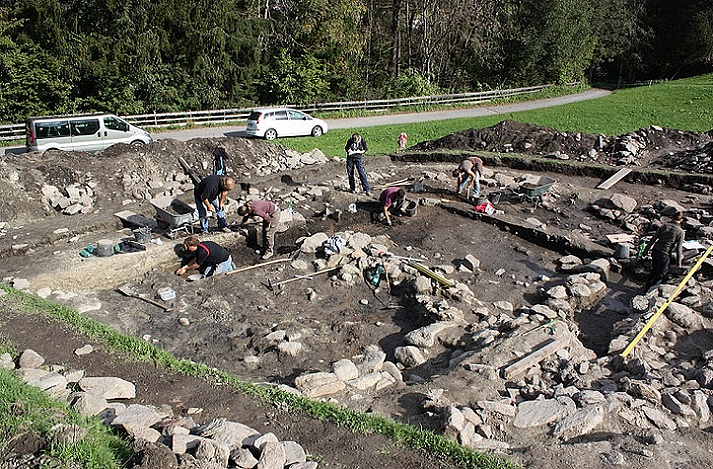
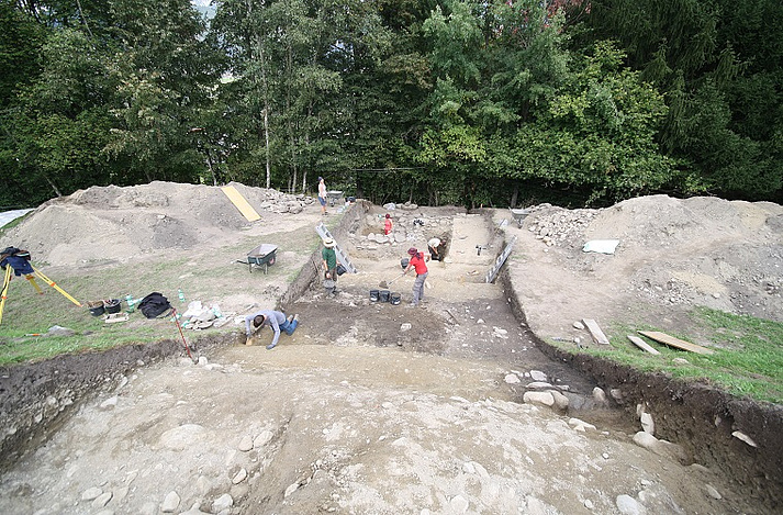
On-site excavations are performed by Markus Wild (Dig It! Company) and Tamara Senfter (Talpa Company) together with a team of students from Munich and Innsbruck.